Monday, March 31, 2008

March Goes Out Like A Lion

In The Weather Alternative's March 8th post entitled Thoughts About the End of March, I focused on the storm-breeding potential of the Full Moon Chart. Based on this, the forecast stated major weather changes will be underway for the West Coast, Great Basin, and Rockies starting around March 26th and continuing through the 30th. The most likely scenario is that a very strong low pressure system or cold front will penetrate the Pacific Northwest with high winds and storms as it pushes eastward into the Great Basin and Rockies.


Results


On the 26th, the Weather Channel reported


Active Northwest and Midwest


A storm system will impact the Pacific Northwest today, bringing rain, mountain snow, and gusty winds to area.
Gusty winds will be felt as far south as southern California.
Snow advisories are in effect for much of the Oregon Cascades and the coastal range. Snow levels around 1000 feet, could drop to 500 feet by tonight.


The Weather Channel's report for the 27th read


A new storm system will bring a cold front into the Pacific Northwest on Friday, renewing the threat for heavy rain over western Washington and Oregon, but also extending that threat into northern and central California.
Heavy snow will increase through the Cascades, into the northern California Mountains.
Gusty winds will also develop through the Northwest, and extend into parts of the Southwest as well.


Similar reports were issued on the 28th, 29th, and 30th confirming the long-range forecast.


The same post warned about a planetary set-up over Kansas, which would affect the Plains. The forecast stated When this is triggered between March 28-30, we can expect an important low pressure system to develop in the Plains and push toward the Mississippi Valley potentially creating severe weather conditions. More information about this was included in my original forecast for March 2008.


The Accuweather map at left above for March 29th called for a potentially serious situation in the country's midsection with possible rainfall amounts of 4 to 5 inches and more flooding.
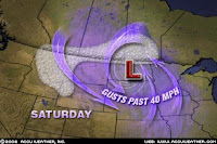


At the same time a storm brought howling winds and snow to the northern Plains.


Finally, The Weather Alternative long-range forecast called for a low pressure system and possible blizzard conditions for the Northeast from the 27th through the 31st.

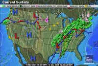
The Weather Channel map at left for the 28th shows a low pressure area bringing rain and snow over the Northeast and New England. Tomorrow, April 1st, locally heavy rain and gusty winds are expected but no blizzard conditions have been mentioned.

All in all, the Full Moon indications have played themselves out very well, and have been a good indication of the weather that resulted.

March Forecasts

Thoughts About the End of March

April Forecasts

Introduction to the Weather Alternative

How Long-Range Forecasts Are Made

Temperature Monitors Report Widescale Global Cooling

Anti Global Warming Skeptics are a Tiny, Tiny Minority, says Gore. However, science is not based on what the majority says but on observation and experimentation. Many popularly held theories were wrong as history attests.

“If you had a million dollars in the bank but didn’t know how to write a check, it wouldn’t do you much good, would it? If you had a car in your garage but had lost the key with which to start it, you wouldn’t get anywhere very fast, would you? That’s about the way humanity is operating today. Quite a few years ago, when I was unhappy and greatly troubled, I found out how I can call upon a power that, if I used the right key, would always give me everything I needed . . . Why not try God?” --Mary Pickford
Saturday, March 29, 2008

Parade of Moisture

The storm conditions for the eastern Plains and Mississippi Valley referred to in The Weather Alternative's long-range forecast for March 27-30 have materialized right on schedule. The wet weather, due to the Mercury and Venus conjunctions to Uranus, manifested as a large corridor of rain, in some places 2 to 3 inches, from the southern New England coast all the way west to the Midwest.


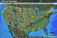
The Weather Channel map for March 28th above shows a low pressure area over the eastern Plains and rain over the Mississippi Valley.


Today Accuweather reports that The South Central states will have thunderstorms today as...Warm, moist air from the Gulf of Mexico will interact with a low pressure system coming out the Rockies today to ignite the storms. There is the threat for damaging winds, hail and isolated tornadoes with these storms.

March Forecasts

April Forecasts

Introduction to the Weather Alternative

How Long-Range Forecasts Are Made

Temperature Monitors Report Widescale Global Cooling

Anti Global Warming Skeptics are a Tiny, Tiny Minority, says Gore. However, science is not based on what the majority says but on observation and experimentation. Many popularly held theories were wrong as history attests.

Defeat

Defeat in due course comes in one way or another to everyone. So the question isn't whether or not you experience defeat, but how you handle it.


What are you going to do with defeat? Let it destroy you, or turn it into a positive, creative experience from which you can extract much know-how and wisdom; and thus gain strength to stage a comeback? The individual who has at the center of his thinking the affirmation "I can do all things through Christ" can recover from any defeat and creditably handle any situation. -- Dr. Norman Vincent Peale

Monday, March 24, 2008

The Mercury-Venus Conjunction and Weather

Portions of central and southern Texas had a wet and dreary Easter Sunday in accordance with The Weather Alternative's long-range forecast for March 23-25. The conjunction between Mercury and Venus, which centered over 99 west longitude was the astrological reasoning behind the forecast that call for a warm and moist air mass to be pulled northward over Texas and the Plains setting off storms.

The wet weather was pretty much confined to the Texas area and not to the rest of the Plains as the forecast suggested.

March Forecasts

April Forecasts

Introduction to the Weather Alternative

How Long-Range Forecasts Are Made

Temperature Monitors Report Widescale Global Cooling

935 False Statements?

"Spectacular achievement is always preceded by unspectacular preparation." -- Dr. Robert Schuller

Often our low status in life is not because our abilities are inferior, but because our opinion of ourselves is inferior. Reevaluate yourself. Maybe you're a superior type who has settled for being a lesser personality. If so, make up your mind today, right now, to re-gear your thinking, revise your strategy and rebound from where you are to where you should be. Let the contagion of enthusiasm grip your mind. It can make all the difference. -- Dr. Norman Vincent Peale

Saturday, March 22, 2008

Sun Square Pluto and Heavy, Wet Snow

The Weather Alternative's long-range forecast for March 20-22 specified that A front or low-pressure system tracks through the eastern U.S. bringing storms from Michigan through the Southeast. The forecast took into consideration the Sun's square to Pluto on the 21st.

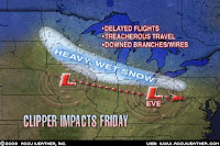
The accompanying Accuweather map for Friday, March 21st shows a band of heavy, wet snow affecting Michigan and surrounding states, and enumerates other weather woes such as delayed flights, treacherous travel, and downed branches and wires. The low pressure system dumped over a foot of snow in some areas. The Southeast was untouched.

March Forecasts

April Forecasts

Introduction to the Weather Alternative

How Long-Range Forecasts Are Made

Temperature Monitors Report Widescale Global Cooling

935 False Statements?

Let Bing Tell You


Attitude. (Charles Swindoll)

The longer Ilive, the more Irealize the impact of attitude on life. Attitude, to me, is more important than education, than money, than circumstances, than failures, than success, than what other people think or say or do. It is more important than appearance, ability, or skill. It will make or break a company, a church, a home.


We have a choice every day regarding the attitude we will embrace from that day. We cannot change our past, we cannot change the fact that people will act in a certain way. The only thing that we can do is play on the one string that we have, and this string is attitude. Iam convinced that life is ten percent what happens to me and ninety percent how Ireact to it. And so it is with you. We are in charge of our attitudes.


Wednesday, March 19, 2008

Mississippi Valley Storms

The Weather Alternative issued a long-range forecast at the end of February calling for storms over the Mississippi Valley between March 17-19.

The Weather Channel map at right shows a low pressure system on the 19th soaking the Mississippi Valley. The following comment is from the Weather Channel on the 18th:

Over the Southern Plains and Lower Mississippi Valley, both severe thunderstorms and heavy rain will cause problems today. The severe threat today will be large hail, damaging winds, and tornadoes, with thunderstorms organizing into a squall line late today into tonight over East Texas through the Lower Mississippi Valley and the severe threat shifting to more of a high wind threat...Flood and flash flood watches extend from Central Texas through the Mid-Mississippi and Ohio Valleys into central Pennsylvania.

March Forecasts

April Forecasts

Introduction to the Weather Alternative

How Long-Range Forecasts Are Made

Temperature Monitors Report Widescale Global Cooling

935 False Statements?

Let Bing Tell You

Saturday, March 15, 2008

A Few Forecasts For April 2008

April's weather in the United States will be affected by a number of planetary alignments including squares from Mercury and Venus to Pluto, as well as squares from Mercury and Venus to Mars to name a few.

The Sun's ingress into Aries takes place on March 19th and is one of the main charts to consult for the development of weather patterns. The following forecasts are based on this chart. Time permitting, I'll post other forecasts for April based on other key charts.

April 2-5
Storm emergencies center around 85 west longitude (from Michigan south through the Florida Panhandle) due to Mercury's square to Pluto, which is now stationary and turning retrograde. By the 5th storms affect the mid-Atlantic and Southeast with potential for damaging winds. (Comment added March 23: Indications in the New Moon chart suggest a low pressure area will center over or pass through the Ohio Valley region.)

April 9-11
An outbreak of storms is indicated over the mid-Atlantic and Southeast. As Mercury perfects its square to Mars storms and windy conditions are shown for New England.

April 13-15
The Sun and Mercury will sextile Neptune, which will coincide with warm and fair conditions over the western U.S.

April 18-22
A series of trines and parallels from both the Sun and Mercury to Saturn will lower temperatures over the Rockies and may trigger precipitation.

April 22-24
Cool and breezy weather is indicated over the eastern Plains and Mississippi Valley.

April 24-26
Venus now sextiles Neptune bringing an increase in temperatures and fair conditions over the western states.

April 27-29
Cool and fair conditions are expected over the Rockies and Plains.

April 28-29
A storm system, brought on by Mercury's square to Neptune will enter the West Coast.

March Forecasts

Introduction to the Weather Alternative

How Long-Range Forecasts Are Made

Temperature Monitors Report Widescale Global Cooling

Wednesday, March 12, 2008

The Calm Before the Storm

Accuweather warns us that Another significant storm is set to develop over the Plains during the next couple of days and move eastward. This system will begin to build Thursday, then strengthen Friday and Saturday while heading for the mid-Atlantic. Ample Gulf moisture and a deep low pressure system will combine to create violent, severe storms along the low's track.


This will coincide with The Weather Alternative's long-range forecast for March 14-16: Another potentially active period over the Mississippi Valley and eastward. Severe thunderstorms are possible.


The Weather Alternative also carries a long-range weather forecast for this weekend for out West.

March 15-19

This will be an active period for the West Coast. Mercury and Venus will perfect their oppositions to Saturn. All of these are located along the California coast and promise a parade of storms over the area between these dates.

The Accuweather map above shows a storm that will produce rain and mountain snow showers this weekend, although they are unaware that the oppositions from Mercury and Venus to Saturn are behind the storm.

The Weather Alternative forecast for March 11-13 called for Windy conditions or storms packing dangerous winds are indicated over the Mississippi Valley area.

So far this forecast period, which ends tomorrow, has not shown much in the way of winds. There have been a few reports, however, from Louisiana, Arkansas, Oklahoma, and Missouri. The National Weather Service reported today that:

SHREVEPORT LA 521 AM CDT WED MAR 12 2008

ON THURSDAY AS THE SURFACE HIGH IN THE GULF MOVES EAST AND A SURFACE LOW TAKES SHAPE OVER THE PAN HANDLES OF TEXAS AND OKLAHOMA. THE PRESSURE GRADIENT WILL BE TIGHTENING ACROSS THE FORECAST AREA ON THURSDAY AS WE WILL BE BETWEEN THE LOW TO THE NORTHWEST AND HIGH OFF TO THE EAST. EXPECT SURFACE WINDS TO INCREASING FROM THE SOUTH AND APPROACHING LAKE WIND ADVISORY CRITERIA INTO THE MID DAY HOURS AND INTO THE AFTERNOON.

THIS OUTLOOK IS FOR NORTHWEST AND WEST CENTRAL ARKANSAS AS WELL AS MUCH OF EASTERN OKLAHOMA.

BREEZY ...BUT CONTINUED WARM TEMPERATURES WILL BE THE RULE TODAY AS THE PRESSURE GRADIENT TIGHTENS BETWEEN LOW PRESSURE TO THE NORTH AND HIGH PRESSURE TO THE SOUTH.

THIS HAZARDOUS WEATHER OUTLOOK IS FOR PORTIONS OF THE MISSOURI OZARKS AND EXTREME SOUTHEAST KANSAS.

MODERATELY GUSTY SOUTHWEST WINDS WILL LEAD TO AN INCREASED RISK FOR RAPIDLY SPREADING GRASS FIRES..

March Forecasts

Introduction to the Weather Alternative

How Long-Range Forecasts Are Made

I Would Like To Buy A Hamburger- Inspector Clouseau

Saturday, March 08, 2008

Thoughts About the End of March

The Full Moon of March 21, 2008 promises some severe weather patterns for the U.S. at the end of March. As can be seen from the astro-locality map on the right, a number of planets occupy angular positions (represented by the different colored lines on the map) at the time of the Full Moon. In addition to this, these planetary lines cross with each other at different locations especially over the western U.S. and over the Plains. I've circled these crossings or "parans" to make them more obvious.


These crossings, along with planetary aspects in the most recent lunar eclipse chart, indicate that major weather changes will be underway for the West Coast, Great Basin, and Rockies starting around March 26th and continuing through the 30th. The most likely scenario is that a very strong low pressure system or cold front will penetrate the Pacific Northwest with high winds and storms as it pushes eastward into the Great Basin and Rockies.


The planetary crossing over Kansas involves the Sun, Moon, and Jupiter at the time of the Full Moon. The Sun and Moon will be square Pluto at the time of Full Moon adding storm-breeding potential to the mix. When this is triggered between March 28-30, we can expect an important low pressure system to develop in the Plains and push toward the Mississippi Valley potentially creating severe weather conditions. More information about this was included in my original forecast for March 2008.


In that same forecast, I mentioned that the Northeast would be affected by storms between March 29-31. After studying the New Moon map for March, I believe indications in this chart will amplify the time period somewhat.


New Moon indications show that weather changes are underway for the Northeast as early as March 27th when a low pressure system infiltrates the region with perhaps blizzard conditions. I say this because today (March 8th) the Northeast is experiencing just that--blizzard conditions, and these are due to the Sun's conjunction to Uranus in the very New Moon map that took effect yesterday, and which will be triggered on March 27th.

March Forecasts

Introduction to the Weather Alternative

How Long-Range Forecasts Are Made

Interesting Clips

The Coming One-World Government

Spiritual Power

Wednesday, March 05, 2008

Sun-Uranus: Winter Storm Saturday

This Saturday the Sun conjoins Uranus, a planet traditionally associated with cold air masses. The Weather Alternative made note of this conjunction in its long-range weather forecast for March 5-8, 2008. The forecast noted that in key charts the Sun-Uranus conjunction would affect the Rockies and the Northeast.


March 5-8

Aspects between the Sun and Uranus are known to lower temperatures and bring cold, dry air. The Rockies is the focal point now. Storms are likely to be triggered as the colder air mass moves into the region. A similar setup is shown over the Northeast.


Here's the tie in: Today a storm system is forming over the Rockies. It will then intensify over Texas and possibly become a major snowstorm over the Northeast by Saturday.

Here's the snow storm in the Rockies:

URGENT - WINTER WEATHER MESSAGE
NATIONAL WEATHER SERVICE
PUEBLO CO 302 PM MST WED MAR 5 2008

...WINTER STORM IMPACTING PORTIONS OF SOUTHERN COLORADO....HEAVY SNOW IS EXPECTED OVER THE SANGRE DE CRISTO MOUNTAINS...THE SOUTHEAST MOUNTAINS AND THE ADJACENT PLAINS TONIGHT AS AN UPPER LEVEL STORM SYSTEM MOVES ACROSS NORTHERN NEW MEXICO.

The Accuweather graphic above shows the storm as forecast for this Saturday over the Northeast.


In an earlier forecast for March 4-7, The Weather Alternative pinpointed the Mississippi Valley as an area where storms would be triggered. The map at left for March 4th shows storms traversing the area.


Today, the 5th, another low pressure area can be seen in the map at right over the northern Mississippi Valley.

March Forecasts

Introduction to the Weather Alternative

How Long-Range Forecasts Are Made

The Coming One-World Government

Saturday, March 01, 2008

Venus, Pluto and Midwest Weather

On February 28th, Venus formed a parallel to Pluto. This was the basis of the Feb 28-Mar 1 Weather Alternative long-range forecast that called for a stormy period for the Mississippi Valley area due to Pluto's position in the winter solstice chart. The forecast read:

A stormy period looms for the Mississippi Valley area. A cold air mass will swirl into the area prompting potentially severe storms.

The accompanying Weather Channel map for February 29th shows snow and rain affecting the forecast area. Storms did stay below severe limits.

March Forecasts

Introduction to the Weather Alternative

How Long-Range Forecasts Are Made

The 2008 International Conference on Climate Change

The 2008 International Conference on Climate Change is the first major international conference to focus on issues and questions not answered by advocates of the theory of man-made global warming.

Hundreds of scientists, economists, and public policy experts from around the world will gather on March 2-4, 2008, at the Marriott New York Marquis Hotel on Manhattan’s Time Square, to call attention to widespread dissent in the scientific community to the alleged “consensus” that the modern warming is primarily man-made and is a crisis.


The global warming debate that the public and policymakers usually see is one-sided, dominated by government scientists and government organizations agenda-driven to find data that suggest a human impact on climate and to call for immediate government action, if only to fund their own continued research, but often to achieve political agendas entirely unrelated to the science of climate change. There is another side, but in recent years it has been denied a platform from which to speak.

The 2008 International Conference on Climate Change promises to be an exciting event and the point of departure for future conferences, publications, and educational campaigns to present both sides of this important topic.

http://www.heartland.org/NewYork08/newyork08.cfm